Twin Lakes Area to see deluge this weekend
A series of storms headed through the Twin Lakes Area this weekend is expected to bring several inches of rain along with the potential of hail, damaging winds and the outside chance of a tornado, according to meteorologist Charles Dalton with the Little Rock office of the National Weather Service.
"We've got a warm front that's going to lift through the state today and that will eventually wind up in northern Arkansas this evening and tonight," Dalton said Friday morning. "During the late evening hours and through the night, we'll have showers and thunderstorms develop along that boundary, persisting through daybreak."
As of Friday afternoon, the forecast called for up to two inches of rain to fall over Friday night into Saturday morning. The respite Saturday morning, Dalton said, will likely be brief.
"There'll likely bit a bit of a lull and then another round of storms will come tomorrow afternoon and evening as well," the meteorologist said. ""A cold front will move through the state from west tomorrow evening when the fronts come through."
Conditions could become dangerous with any of the storms forecast to hit the area, according to Dalton.
"Some of the biggest threats will likely be large hail and damaging winds," Dalton said. "There's plenty of instability and wind shear to work with. These storms shouldn't have too much difficulty in becoming severe in terms of hail and damaging winds. The biggest question now is how high the tornado threat will be."
The chance for a tornado depends on where storms develop in relation to the warm front, said Dalton who noted that if the storms develop south of the warm front boundary and move north across the boundary, there'll be enhanced risk of a tornado.
The biggest threat
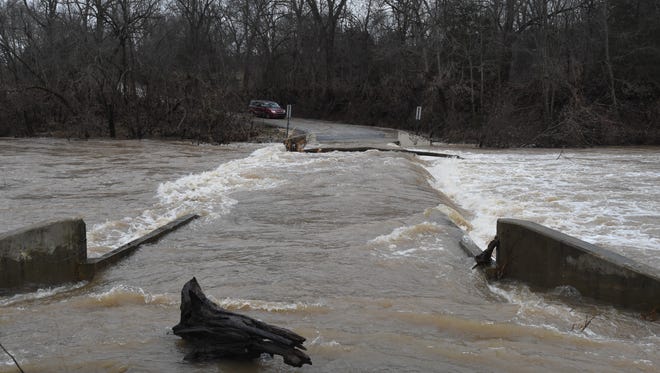
While there is the potential for for hail, damaging winds and potentially tornadoes, the real and expected threat in the forecast right now is flooding. With the area already saturated from recent rainfall and up to six inches or potentially more to fall, flooding will happen in some locations prone to it.
"The biggest threat from this series of storms is going to be flooding and flash flooding. We're dealing with unseasonably and abnormally moist air mass with just a lot of water for storms to take advantage of," Dalton said. "Beginning tonight and through Sunday morning before this thing pushes east through the state, you could wind up getting six or seven inches of rain."
As always, authorities caution motorists not to cross flooded roads and advise those who live in areas that are prone to flooding to keep a close watch on the weather and be ready to evacuate should it become necessary.